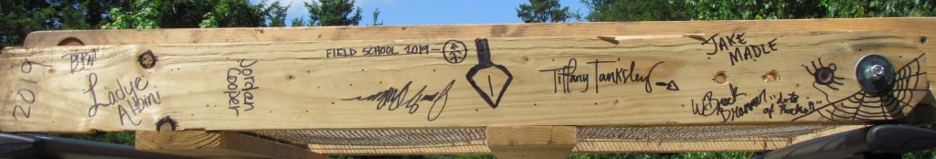
Field Work, May 13-24, 2019
After a very productive two-weeks playing in the dirt and tallying tick totals, we have completed the second season of the UCA Field Archaeology course!
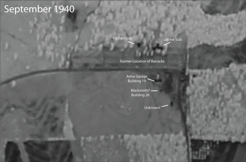
We now know that the Army Garage, Building 19 (Feature 10) was razed October 1937 and converted into a Blacksmith shop, Building 26. Building 19 is visible in the Feb. 1937 aerial image. Only the slab, first recorded during the 2018 field school, is visible in the September 1940 aerial image. There is no evidence of blacksmithing in the remaining Building 19 slab, so it is presumed that the frame of the building was converted into a Blacksmith shop and rebuilt elsewhere at the camp. One possibility is the small square slab south of the Building 19 visible in the September 1940 aerial.
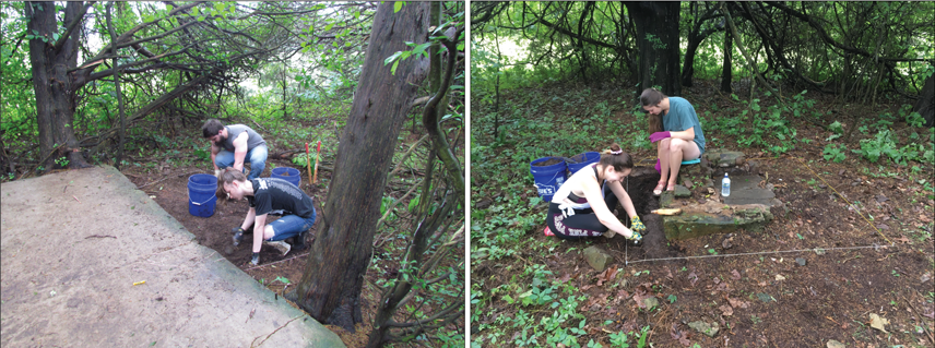
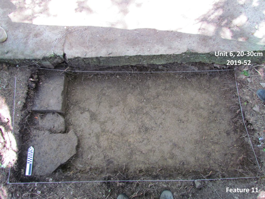
Half way through the field school, excavations began at the possible location of the officer’s quarters (Feature 11). The 1934 inventory of buildings lists “Qtrs for Officers w/screen porch” as a rigid frame structure with five rooms and a capacity of four individuals. Two units were opened. One unit (Unit 6) was opened at the edge of the remaining porch slab to understand the position of the front door of the screened porch. A second unit (Unit 5) was established around the chimney base to evaluate its construction technique.
Excavation at the edge of the patio slab revealed a series of flat stones that likely represent a constructed landing associated with the front door. A large door spring was found in this unit also demonstrating this was the location of the entrance door. A large cedar tree limited further exposure of the constructed landing, although it is hoped that future excavations will allow for a better idea of the size and extent of the stone landing.
The Unit 5 chimney base was also productive by exposing the remaining chimney to evaluate the extent and construction style. A large foundation was constructed under the floor of the house with the chimney built on this foundation. Two large flat stones were centrally placed to form the base of the hearth with large rectangular stones situated around the hearth. Smaller stones were used to create the chimney stack, which has since collapsed with the chimney fall spread to the west (away from the building location).

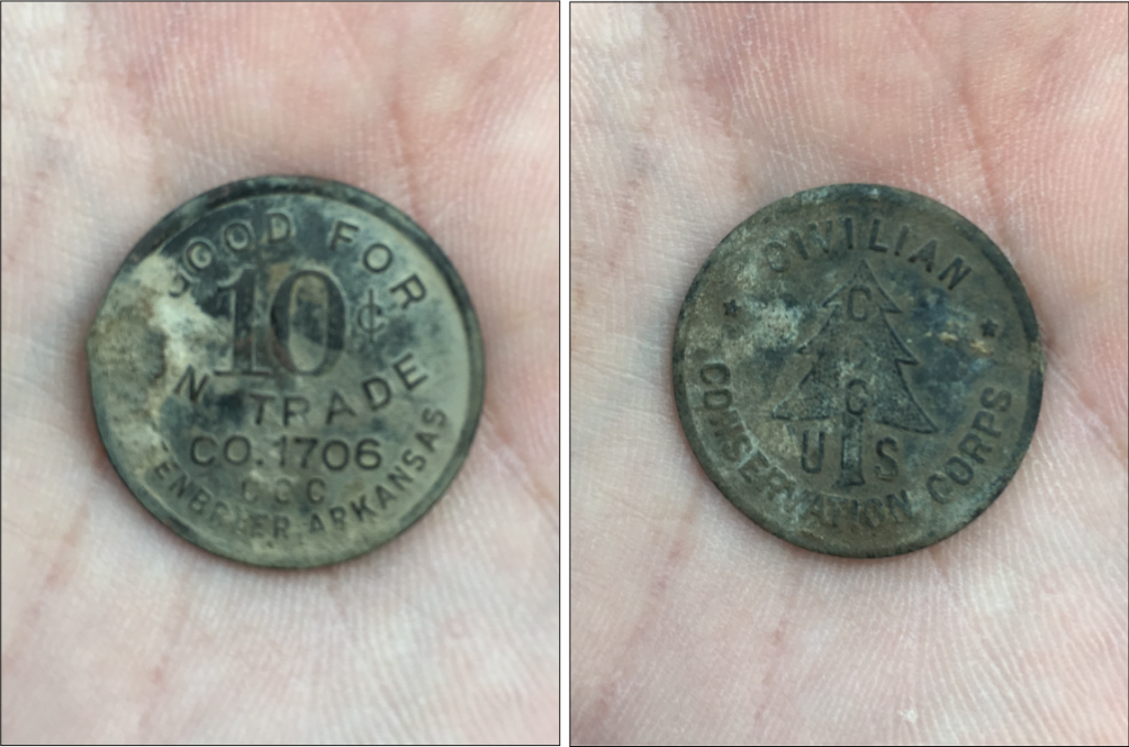
Artifacts found within the hearth include broken glass, nails, and other construction debris. One of the more interesting objects (a highlight of the field season!) is a 10 cent CCC camp token that was found in the fireplace hearth. CCC camp tokens were generally issued in 5 cent and 10 cent denominations to camp enrollees. Coins were made by several camps and labeled with the Company number and location. The token that was found is a 10 cent token with the label CO 1706. Company 1706 is first associated as a forestry camp, of which men transferred from Camp Victor to establish Soil Conservation Service 1 – the first Soil Conservation Service camp in Arkansas – on October 1, 1934. Company 1706 occupied Camp Halsey until November 1, 1935.
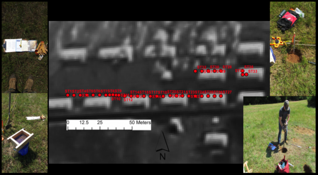
In addition to excavations, testing was also done to evaluate the former location of the enrollee barracks. Resistivity data were collected using a RM Frobisher TAR-3 resistivity meter. Data were overlain on 1937 aerials to evaluate geophysical feature relationships to building locations.
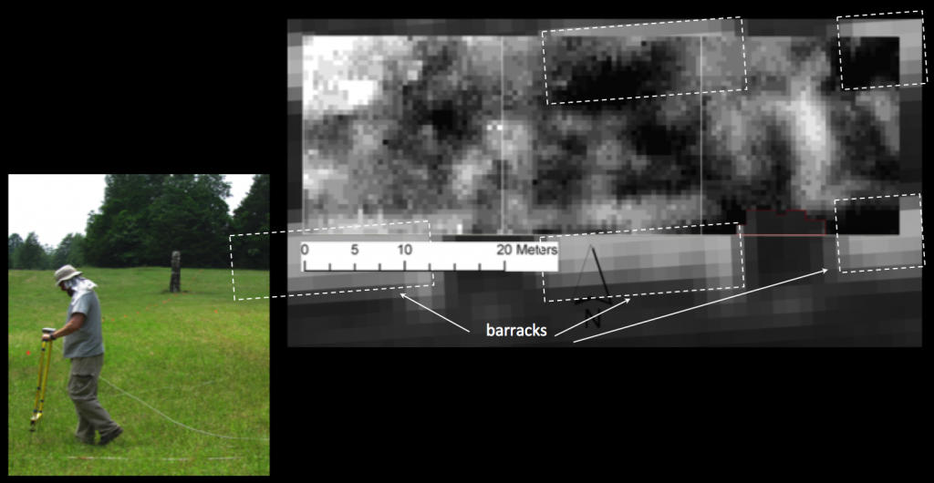
Using these data, 35 shovel tests were dug using a spacing of every 5m and dug at a depth of 35cm and an approximate width of 25cm. Artifacts collected include nails, window glass, and construction debris related to the barracks. The shovel test exercise provided insight into the amount of remaining artifacts and their distribution across the landscape.
The 2019 fieldwork was very productive and students had the opportunity to be exposed to a multi-disciplinary approach to address specific research questions related to social, historical, economic, and political aspects of the camp. Several types of data were collected, which include resistivity data, shovel test data, and feature excavations and their associated artifacts.
The students contributed to a broader project to evaluate Faulkner County historical and archaeological resources and participate in the ongoing research and data collection at Camp Halsey. At the end of the field season, the Halsey’s cooked the field team a picnic lunch where we reminisced about the experience, the heat, the ticks, the interesting artifacts found, the questions we answered, and the questions we created to be explored in future field seasons.
