UCA Field School 2023
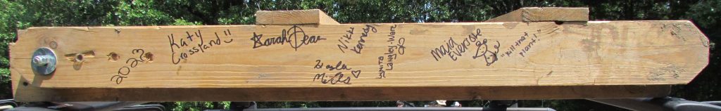
The 2023 UCA Field Archaeology course has officially concluded! The fifth year of field school was another productive year with new data collected, skills learned, and knowledge gained regarding Camp Halsey (3FA313), as well as a day spent mapping an undocumented rural cemetery in northern Faulkner County. And, the weather was great… low humidity and no rain! The 2023 fieldwork added to an understanding of the social, historical, economic, and political aspects of the camp and its role in the surrounding Centerville community. The cemetery fieldwork served to record a previously undocumented cemetery (likely mid-late 19th century) and allowed students to apply archaeological methods to address a specific (and time limited) set of hypotheses about a site.
The first week was spent at Camp Halsey where students were exposed to methods associated with site grid, total station mapping, and electrical resistivity survey. Nine 20 x 20 meter survey grids (0.88 acres) were collected using electrical resistivity. This survey method injects a low voltage current into the ground, which measures and maps variable values of electrical resistance (changes in soil porosity) as a result of natural and cultural landform modifications.
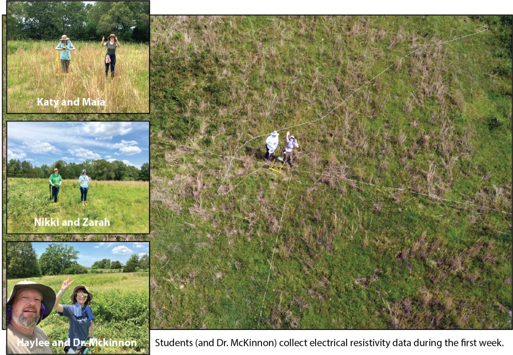
These new survey grids added to the existing resistivity dataset, collected by students during previous field school seasons, and provides an expanded visibility to site activity areas, landscape modifications (terracing), and overall integrity of archaeological remains. Results indicate numerous areas that can be tested during future field schools in order to better understand the organization of the site.
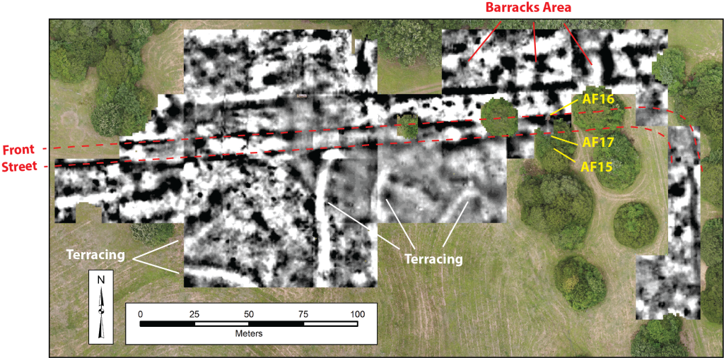
Electrical resistivity survey results collected during the last five years of fieldwork.
During the second week at Camp Halsey, efforts were focused on re-opening the excavation of Architectural Feature 16 (AF16), first explored during the 2022 season. AF16 was initially interpreted as a road culvert on the north side of the former Front Street. To the south of Front Street is a small cluster of flat stones on the surface that was initially interpreted as the “exit” culvert as water moved under the Front Street roadway and drained to the south (and downslope) of the road. This cluster of flat stones was assigned as AF17 but was not explored in 2022. In 2023, goals were to open an 8-meter long trench (two 4-meter long units; Units 12 and 13) between AF16 and AF17 to better understand the construction of the culvert and its relation to the main street through the camp.
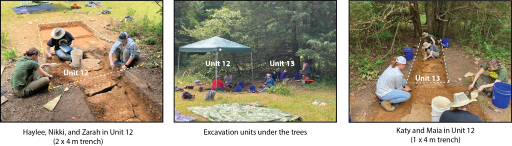
However, excavations revealed that the AF16 culvert is not a simple drainage under the road. It is associated with a complex water management system that captured surface rainwater, as well as rain runoff from the adjoining barracks along Front Street, into a hand-laid stone tunnel (approximately 2 feet tall). As the water moved through the tunnel, it percolated into the ground water and into a dug well associated with the nearby well-house (AF15). AF15 was excavated during the 2022 season as the location of Camp Building No. 23, Pump House Number 2, where it is noted in the 1938 Building Inventory that on April 1, 1935 an “additional well drilled 50’ South of Barrack No. 12” at a cost of $904.00.
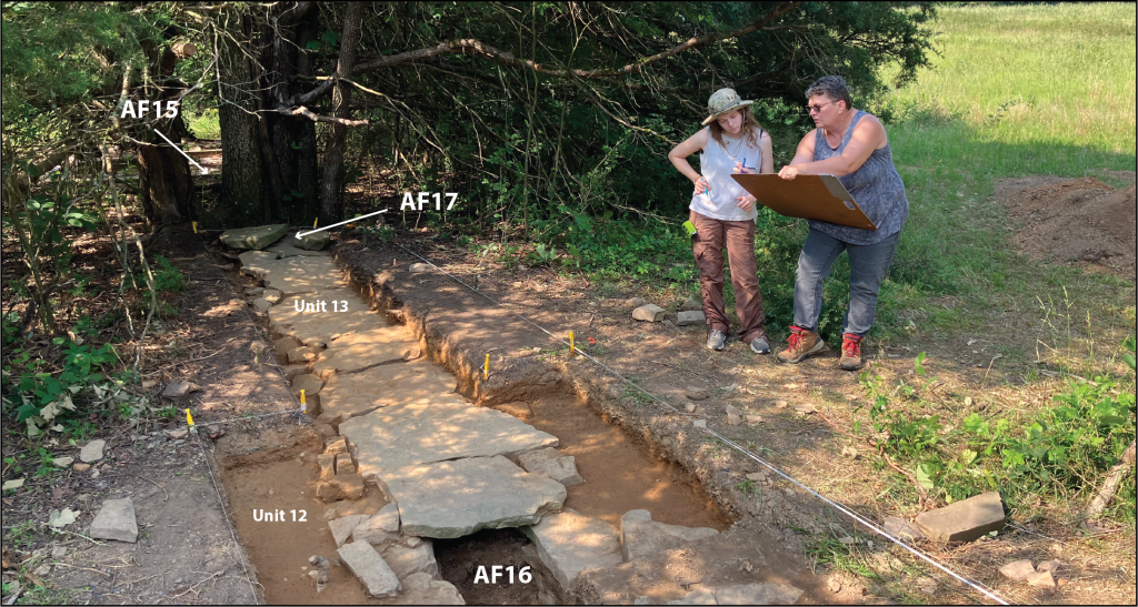
Faulkner County Museum director, Lynita Langley-Ware, and field school student Maia map the completed excavations of the exposed stone tunnel. Remains of the AF15 (well-house) foundation are visible beyond the large tree south of AF17. The well-house nicely aligns with the exposed water management system and AF16 culvert.
In short, 2023 excavations revealed that AF17 was not the remains of an “exit” culvert, but instead were displaced tunnel cover stones that had been pushed up by now-dominating adjoining trees that had grown through the tunnel. The two-foot stone tunnel begins with an open culvert at the north edge of Front Street (AF16), runs south under the shale-lined street, and likely continues beyond the area exposed during this season (Units 12 and 13) under AF17 and toward AF15. Anticipated excavations for the 2024 season will be to expand the trench south of the trees toward the AF15 well-house foundation in order to understand the relationship between the water capture tunnel and the well. The hard work by students this year added to our understanding about landscape modifications at the camp and how water—a scarce resource—was captured and used to support the 200-plus young men living at Camp Halsey between 1934-1935 (Company 1706) and again between 1937-1939 (Company 4748).
Rural Cemetery Work
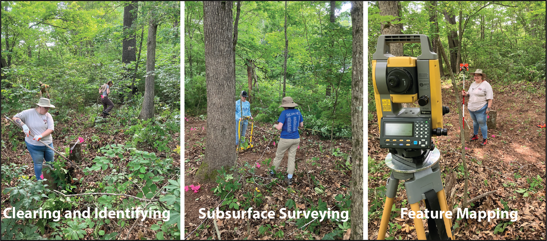
In addition to work at Camp Halsey, students also had an opportunity to map and record a nearby historic undocumented cemetery in northern Faulkner County. As part of the Faulkner County Historical and Archaeological Resources project, the researchers at the Jamie C. Brandon Center for Archaeological Research and Faulkner County Museum have been mapping and recording historic cemeteries throughout Faulkner County, and making those results available to community members.
During the single day of work at the cemetery, not only were students able to apply archaeological methods during a Phase I “CRM-type” recording and documentation project, but they also had the opportunity to understand how archaeological methods can serve a community need as it relates to documenting the past.
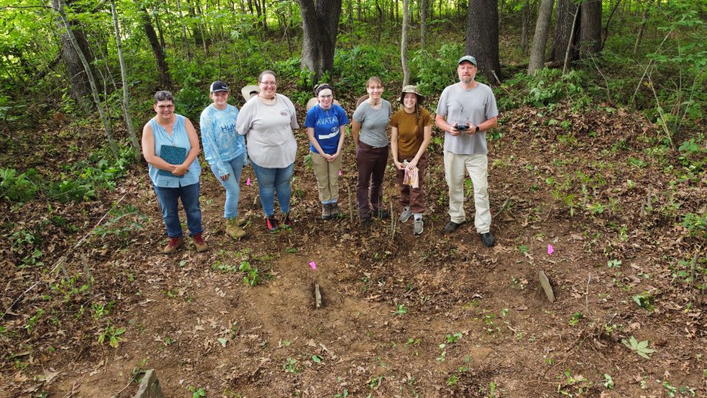
Group photo! End of the day clearing and documenting an unrecorded rural historic cemetery.
After collecting data at both Camp Halsey and at the rural cemetery, the last few days were on UCA campus doing lab work. Students were exposed to artifact cleaning, documentation, sorting, interpretation, and accessioning and curation standards. Artifacts were “bagged and tagged” according to Arkansas Archeological Survey standards. They were also introduced to electrical resistivity and total station data processing and geographic information system (GIS) applications. A familiarity of GIS applications is a critical component to archaeological field work and data analysis where a GIS is used to organize multiple data sets and gain insights on spatial relationships between vector and raster data (collected during the field season) and the formation of new hypotheses to test during future field seasons.